The 6 Most Embarrassing War Stories of All Time
We've previously discussed some of the most hilarious ways grown adults, tasked with either the defense or expansion of their nation, have managed to dick things up so completely that it crosses into the realm of comedy. Here are a few more instances of people stepping onstage in the military theater and splitting their pants in front of everyone.
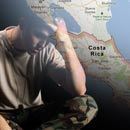
Nicaragua Invades Costa Rica Because of Google Maps

So what's the worst your GPS or Google Maps instructions has ever steered you wrong? Maybe you missed an exit, or wound up in the wrong side of town and got stabbed a bunch of times? Whatever it was, at least you didn't accidentally go to war with a neighboring country.

"In 500 feet, annex Belgium."
Because that happened in November of 2010, when a Nicaraguan Military commander, Eden Pastora, led his men across the border into Costa Rica, which, in no uncertain terms, is pretty much a declaration of war. He claimed the whole thing was a mistake due to being led astray by Google Maps.
To be clear, it wasn't as though Pastora and his guys just stumbled across the border, set up some tents and then hurriedly cleared out in embarrassment once their error was discovered. They leveled a protected forest, dredged the San Juan river (the ownership of which is the sorest point of contention between the two nations), and dumped all the bullshit they scooped out of it into Costa Rican territory (that is, the portion of the land they decided to agree was Costa Rica's, since they were actually several miles inside the country's borders at this point).

It's not clear why he decided to consult an Internet atlas instead of official military charts (which clearly depict the borders that both countries recognize). It's also not clear why it took him so long to figure out where he was. At one point, they took down a Costa Rican flag and replaced it with a Nicaraguan one, presumably because the flag wasn't represented by Google Maps so they assumed it had been erected by mistake. That's like walking into someone's house, throwing out all of their family photos to put up pictures of you and your grandparents, and then trying to tell the police that Mapquest is to blame for giving you shitty directions back to your apartment.
In Pastora's defense, the Google Maps view of the border between Nicaragua and Costa Rica is off by about 3,000 meters (around a mile-and-a-half) in Nicaragua's favor. In Google's defense, their maps are meant to locate Burger Kings, not plan military patrol routes for rival South American nations.

Santa Anna Takes a Nap and Loses Texas

Most of you have probably at least heard of Santa Anna, the Mexican general who defeated several hundred Texan soldiers at the Battle of the Alamo in that movie with Billy Bob Thornton. What you probably haven't heard is how, a few months after the Alamo, Santa Anna parked his army directly next to Sam Houston's much smaller American force by the San Jacinto River and ordered everyone to take a nap. Unsurprisingly, Houston took this opportunity to stomp the living shit out of them and claim independence for Texas.

At the time, Santa Anna was riding pretty high on his Alamo victory, and the conquering of Texas seemed like a mathematical certainty. The soldiers under his command outnumbered Houston's by more than double, so he felt pretty comfortable telling everyone to "take five" while he stood on the banks of the San Jacinto and waved his dick in Houston's face. He didn't even bother to post sentries to keep watch during siesta time, but -- in all fairness -- the sentries were probably tired too.
Presumably, after having to convince himself that the scene before him wasn't some heatstroke-borne sight riddle, Houston plowed his troops through Santa Anna's army while they slept, crushing them in 18 minutes and suffering only nine casualties in the process (to compare, over 600 Mexican soldiers were killed).

Santa Anna himself was taken prisoner, after his attempt to disguise himself as a commoner failed because he neglected to remove his jeweled cuffs and frilly undershirt. Despite desperately wanting to Tiger Knee the general for the slaughter of his compatriots at the Alamo, Houston bartered for the independence of Texas instead and sent Santa Anna back to Mexico.

The U.S. Mistakes an Italian Island for a Libyan Submarine

Back in 1986, Libyan terrorists blew up a German discotheque and, not willing to let this aggression go by unpunished, President Ronald Reagan was determined to send a stern message back to Libya consisting of jets and explosions. Unfortunately, the message got scrambled somehow, like in that game Telephone -- only, instead of ending up with a wacky misinterpretation, the jets accidentally bombed the everloving puddingshits out of an Italian island.

While crossing the Mediterranean Sea on their way to the bombing, American fighter pilots noticed some strange steam rising up out of the water beneath them. If nearly 100 years of movies are to be believed, mysterious ocean steam is never a good thing, and, in fact, is frequently a catastrophically-bad thing that occasionally rhymes with Godzilla. The pilots, clinging to the more rational (but no less knee-jerk) assumption that what they were seeing were telltale signs of an enemy Libyan submarine (does Libya even have any submarines?), dropped depth charges on the source of the steam and continued on to their scheduled bombing raid.
Only later did they discover that the alleged Libyan submarine was actually the volcano Empedocles, located at an underwater island called Ferdinandea, which is a territory of Italy. It didn't used to be underwater, you see, so at one point it was actually worth the effort for the Italians to plant a flag in it before it promptly sank back into the ocean. On their way to immolate some disco-hating Libyan terrorists, the United States inadvertently bombed Italian soil, which is ironic, considering Italians love discos.

Two Generals Mistake the Same Enemy Soldiers for Their Own Men

The Battle of Stoney Creek was a key conflict in the War of 1812, during which two separate American generals confused British soldiers for their own troops and tried to rally them into action, hilariously resulting in both of them being captured.
To be fair, the whole situation was awfully confusing. The battle was the result of a moonlight sneak-attack by British forces on a sleeping American camp. However, the Brits were being supported by auxiliary flanks of Native American soldiers, who let out a war-whoop that alerted the Americans in enough time to form a ragged line of defense. We have to believe this was done on purpose.

The battle was a chaotic nightmare. As the melee became even more jumbled, American General John Chandler rode his horse out into the middle of the bedlam to try and get some idea of what in the mighty fuck was going on. Predictably, his horse was blasted out from under him, and he fell to the ground unconscious.
Chandler awoke moments later to the sounds of commotion coming from the artillery emplacement at the center of the camp. Knowing that artillery was key to winning the fight, Chandler rushed over to try and rally his men to stand strong at their post. He did this despite the fact that he didn't recognize any of the men and that they were all speaking with British accents.

As you may have guessed, the commotion Chandler had heard was the sound of his artillery section being overtaken by the enemy, and he had just run headlong into a swarm of British soldiers, who immediately took him captive.
With Chandler out of the picture, it fell to his second-in-command, William Winder, to rally the American defense. Unfortunately, Winder had also heard the noise coming from the artillery section, and he heroically strode into the emplacement to be captured in the exact same fashion as Chandler had been a few minutes earlier.

Soon after this, the Americans rallied to try to retake the camp, and, as you can guess, they accidentally attacked their fellow Americans instead. Realizing they could not defeat this "British" army, they finally retreated. After just 45 minutes of fighting, the actual (and rather small) British soldiers realized they had won one of the most slapdick military engagements in history.
A Pilot Ejects Just in Time to Watch His Plane Land Itself

It's hard to imagine anything worse than being in a fighter jet that has decided to go spinning out of control. Managing to eject to safety would seemingly guarantee you a badass story to tell at parties for the rest of your life, unless it turned out that A) the plane was actually fine and B) it managed to land itself perfectly without you, as if you were, in fact, the problem all along. This happened to Captain Gary Foust.
During a test run back in 1970, Foust was flying his F-106 interceptor jet when the plane entered a seemingly unrecoverable spin. Upon realizing that the ground was spinning around like his plane had been tossed into God's blender, Foust did the only sensible thing someone would do in that situation -- he got the hell out of his jet.

After ejecting, he watched from his parachute, expecting to see the jet slam into the ground and go up like a meth lab. That is, until one of his wingmen yelled over the radio, "Gary, you better get back in it!" -- which, in Gary's defense, was a ridiculous thing to suggest. All he could do was stare in amazement as his jet, having successfully trolled the shit out of him, promptly recovered from the spin and flew off without a pilot.

Foust's temperamental F-106 proceeded to fly itself in a straight line until it landed almost perfectly in a snowy cornfield below. When police on the ground finally caught up with it, they found the jet's engine still running.

"I wish I had eyes so I could see the look on that sonofabitch's face."
The Air Force, evidently fearful of whatever demon had taken control of the plane, instructed the police to just sit and wait until it ran out of fuel rather than climb in and attempt to shut it off. When it finally did sputter to a stop, the Air Force repaired the damage and put it right back into service, because, in all fairness, the jet was a damn fine pilot.
The Japanese Accidentally Flood Their Own City With a Battleship

In 1940, Japan, although not yet at war with the United States, wanted to thoroughly outmatch its Navy. So they commissioned the battleship Musashi, which, nearly double the size of the Iowa, was the largest battleship ever fielded by Japan In fact, the Musashi was so massive and displaced so much water that, when it was finally launched, it triggered a 4-foot-high tidal wave that flooded Nagasaki.

Japan really concentrated on outfitting the Musashi with every gun that had ever existed. Its main cannons fired shells that were 18 inches across over a distance of 26 miles, which is almost enough to kill dinosaurs while orbiting the Earth. Unfortunately, there is a problem with launching a ship designed to scuttle moons, and the problem went undetected by the Japanese Navy -- because, apparently, none of them had ever put a fat child in a bathtub.
So, they pushed the lumbering beast into the water, and could only watch helplessly as the huge wave generated by the Musashi went crashing through the harbor and cascading up several rivers, capsizing almost every other ship in its wake and flooding all of the houses along the riverbanks. Despite being dangerous and humiliating, the Musashi's rampaging displacement arguably suggested a new strategy to the commanders of the Imperial Navy.

"We should have saved the ammo and just dropped this thing next to America."
Confused residents who had been confined to their homes to protect the secrecy of the Musashi's launch became far more confused when seawater burst through their doors like the wildebeest stampede in The Lion King. After rushing outside to avoid drowning, the people were shooed back inside their partially-submerged houses by the Japanese military, who either quickly fabricated some excuse, or simply pretended that nothing was out of the ordinary. Hell, it's not as though they would have believed the truth.
Xavier Jackson can be reached at XavierJacksonCracked@gmail.com or you can Like his Facebook page. Richy Craven writes about Batman and tweets occasionally. Dustin Koski writes regularly for toptenz.net, though you wouldn't know it to look at him.
For more war stories that are more like black comedies, check out 5 Soldiers Whose Horrific Injuries Only Made Them Angry and 6 WWI Fighter Pilots Whose Balls Deserve Their Own Monument.
If you're pressed for time and just looking for a quick fix, then check out 3 Insane Marriage Proposals (That Actually Worked).
And stop by LinkSTORM to learn how to be the best Grinch you can be.
Do you have an idea in mind that would make a great article? Then sign up RIGHT NOW and pitch your first article today! Do you possess expert skills in image creation and manipulation? Mediocre? Even rudimentary? Are you frightened by MS Paint and simply have a funny idea? You can create an infographic and you could be on the front page of Cracked.com tomorrow!
And don't forget to follow us on Facebook, Twitter, and Tumblr to get sexy, sexy jokes sent straight to your news feed. Are you on Google+? So are we!
