20 Historical Maps Getting Things Just a Bit Wrong

Maps are supposed to show us where we are, but sometimes they’re less about geography and more about guessing. Centuries ago, mapmakers drew oceans where there were mountains, made rivers flow uphill, and convinced entire nations that mythical lands existed.
Some errors were accidental, others... less so. Early explorers copied sketches from travelers who might have been drunk, or artists added monsters for dramatic flair. The result is maps that make today’s GPS look like witchcraft.
From continents that don’t exist to countries with the wrong shape entirely, these historical maps prove that humans have always been terrible at directions, and occasionally hilarious about it.
Great Lakes (16th–17th c., North America)
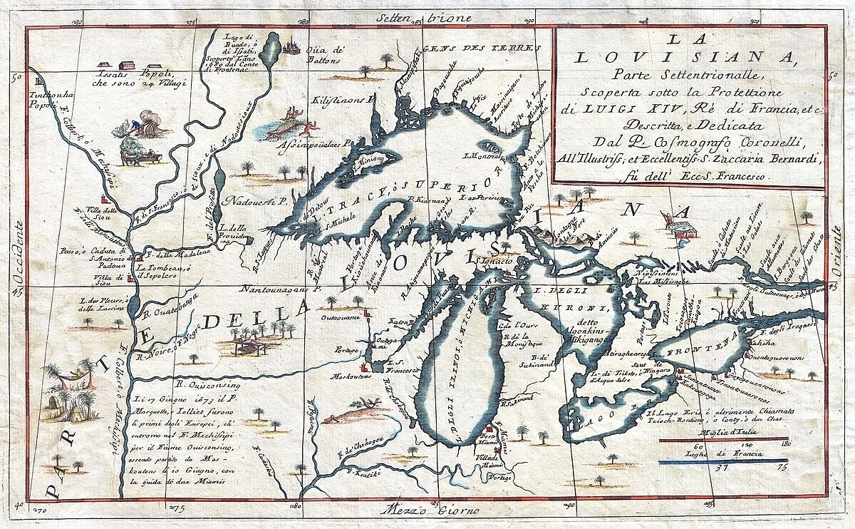
Lakes drawn too large or connected wrong, rivers misdirected.
T-O Maps (Medieval Europe)
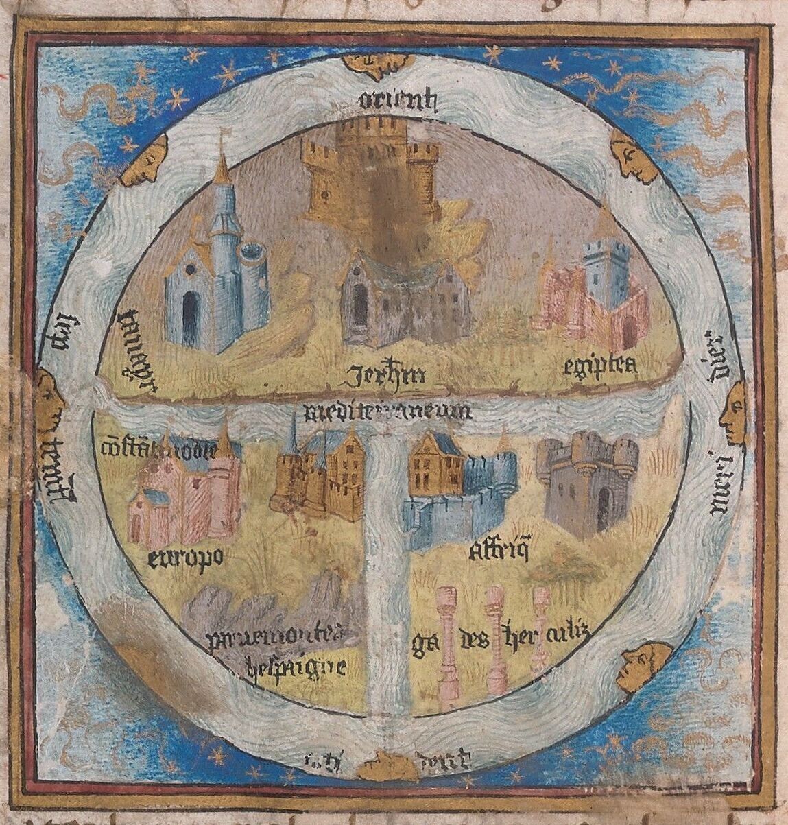
World divided into Asia, Europe, and Africa; schematic, not geographic.
Dead Sea Strait (Biblical, Middle East)
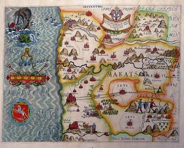
Dead Sea shown as strait connecting Mediterranean to Persian Gulf.
Great Game (19th c., Central Asia)
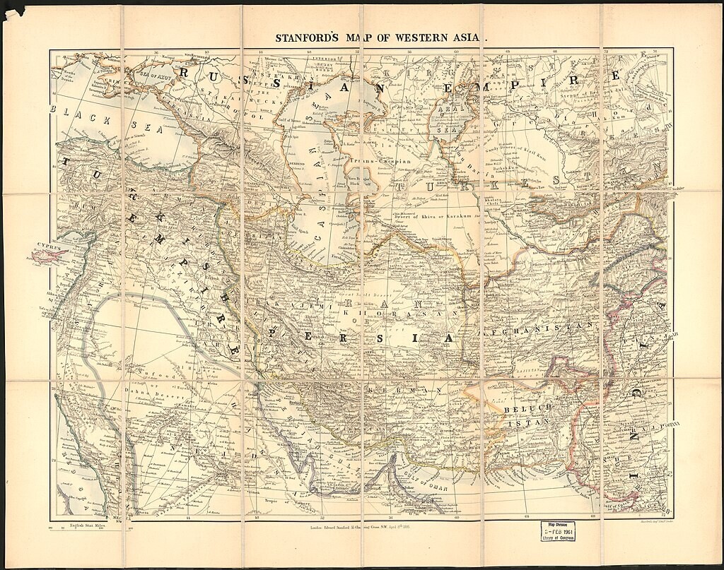
British and Russian influence exaggerated; rival territories minimized.
Panama Canal (Pre-1914, Central America)
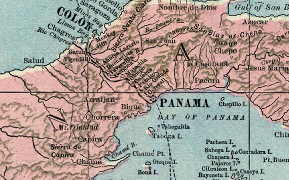
Various canal routes drawn; some completely wrong.
Phantom Islands (16th–17th c., Pacific)
Islands like Freycinet appeared due to navigational errors or fog sightings.
Waldseemüller (1507, Europe)
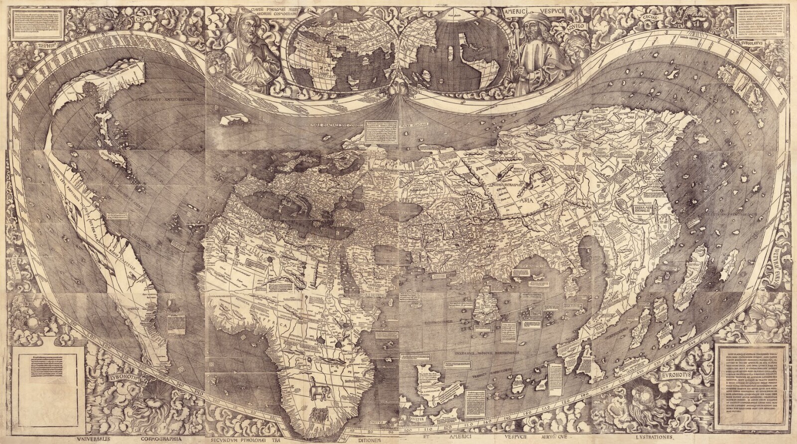
South America as peninsula, North America barely separated from Asia.
Crooked Americas (Pre-18th c., Americas)
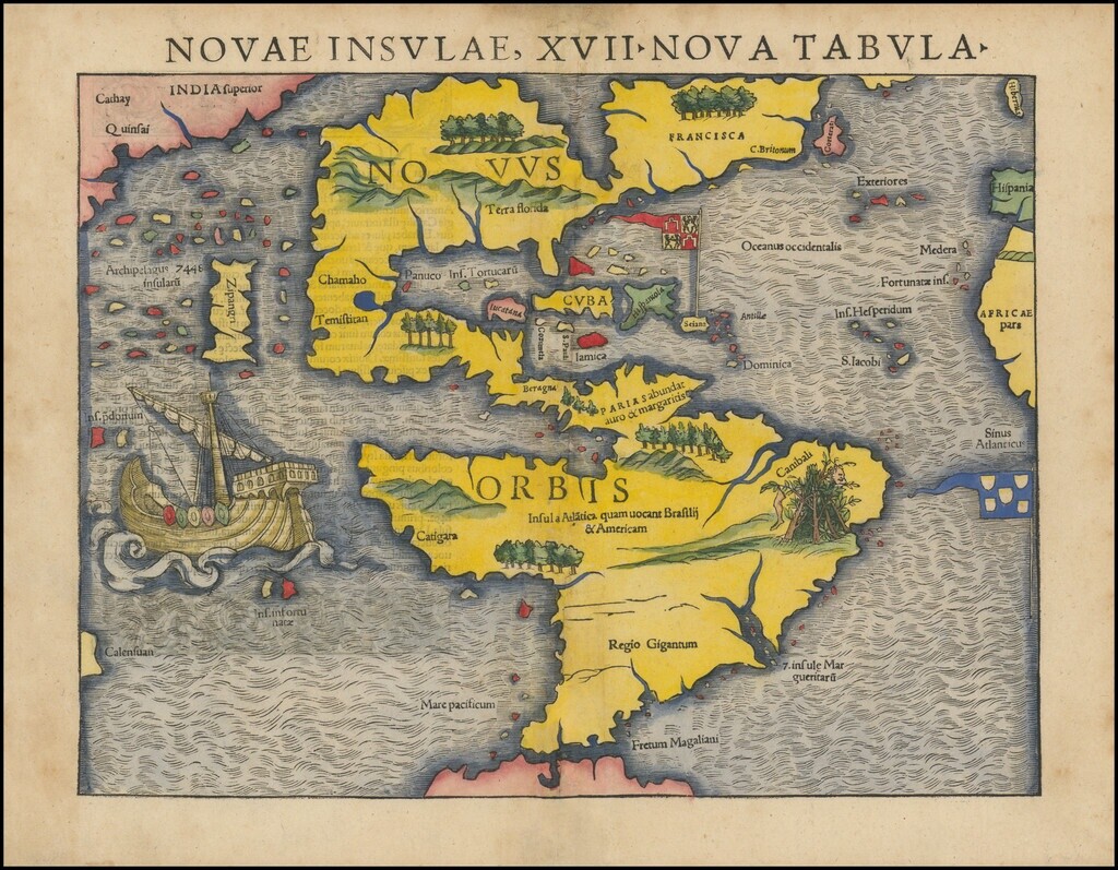
Coasts too narrow or tilted; Pacific and Atlantic misrepresented.
China-Centric (Early, China)
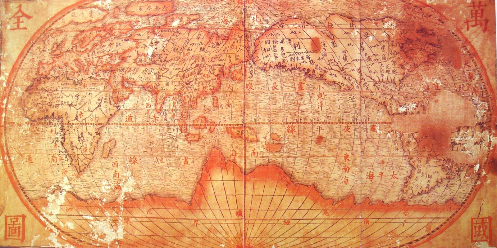
China oversized, foreign lands tiny, distorting global scale.
Garden of Eden Map (17th–18th c., Near East / Asia)
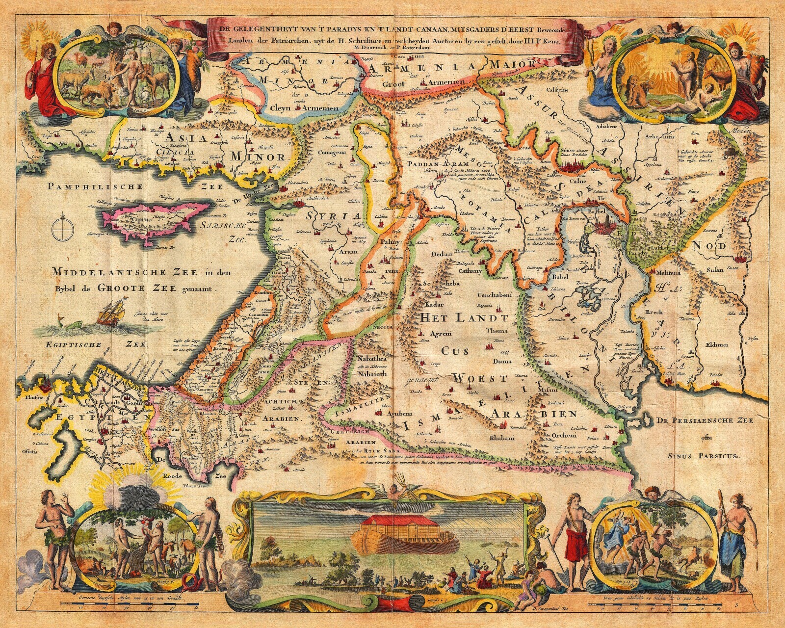
Map showing Mesopotamia, Armenia, including the Garden of Eden near the Tigris and Euphrates.
Sea Monsters (16th–17th c., oceans)
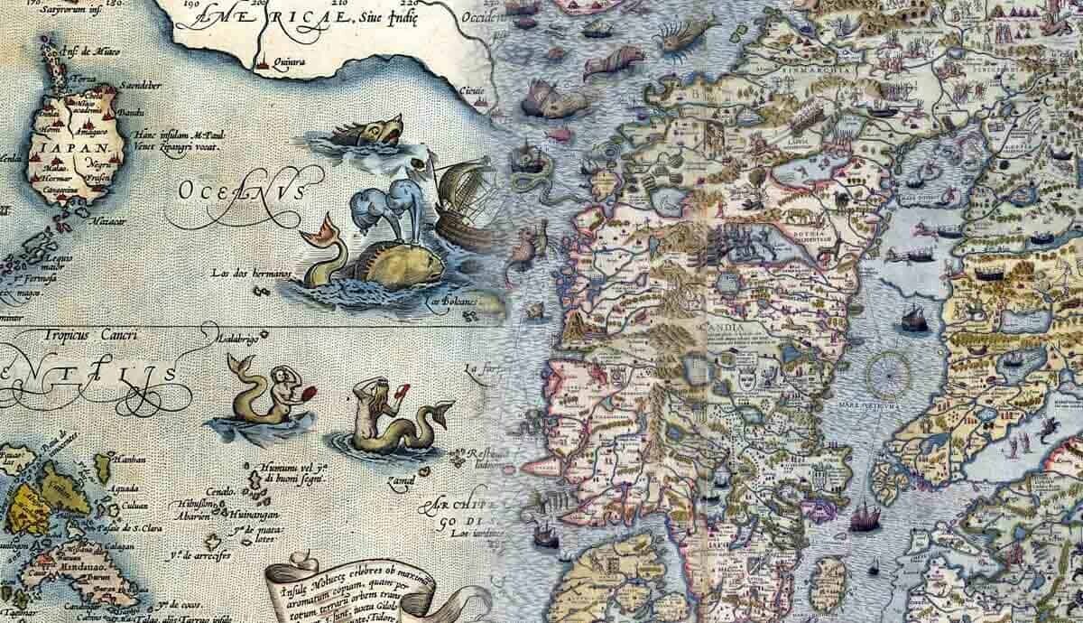
Unknown waters filled with krakens, hydras, and giant sea serpents.
Hereford Map (c. 1300, England)
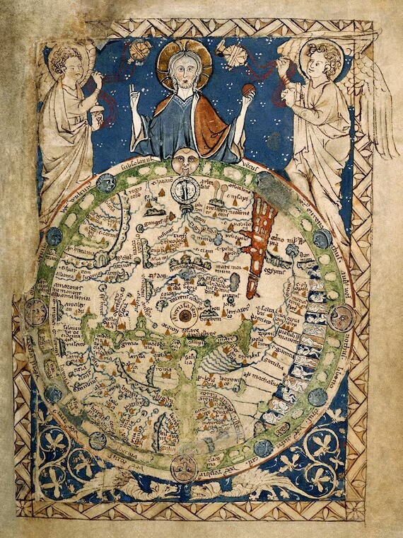
East-up orientation, Jerusalem central, monsters and biblical figures included.
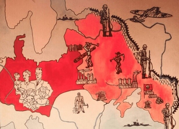
Cold War (1947–1991, global)
Ideological blocks simplified with bright colors, ignoring non-aligned countries.
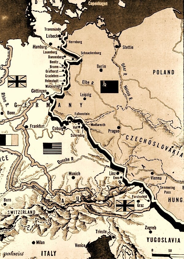
Nazi Maps (1933–1945, Europe)
Borders redrawn to justify Lebensraum, ignoring reality on the ground.
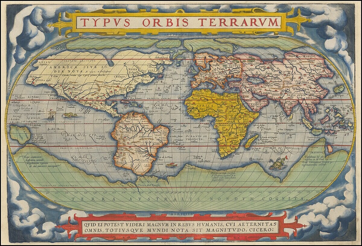
Mercator (1569, global)
Polar lands exaggerated; Greenland looks enormous versus equatorial regions.
Río de la Plata (16th–17th c., South America)
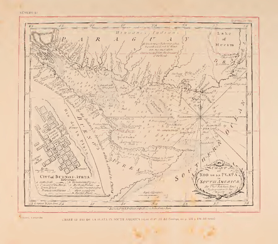
River mouth misplaced, distorting Argentina-Uruguay boundaries.
California Island (17th–18th c., North America)
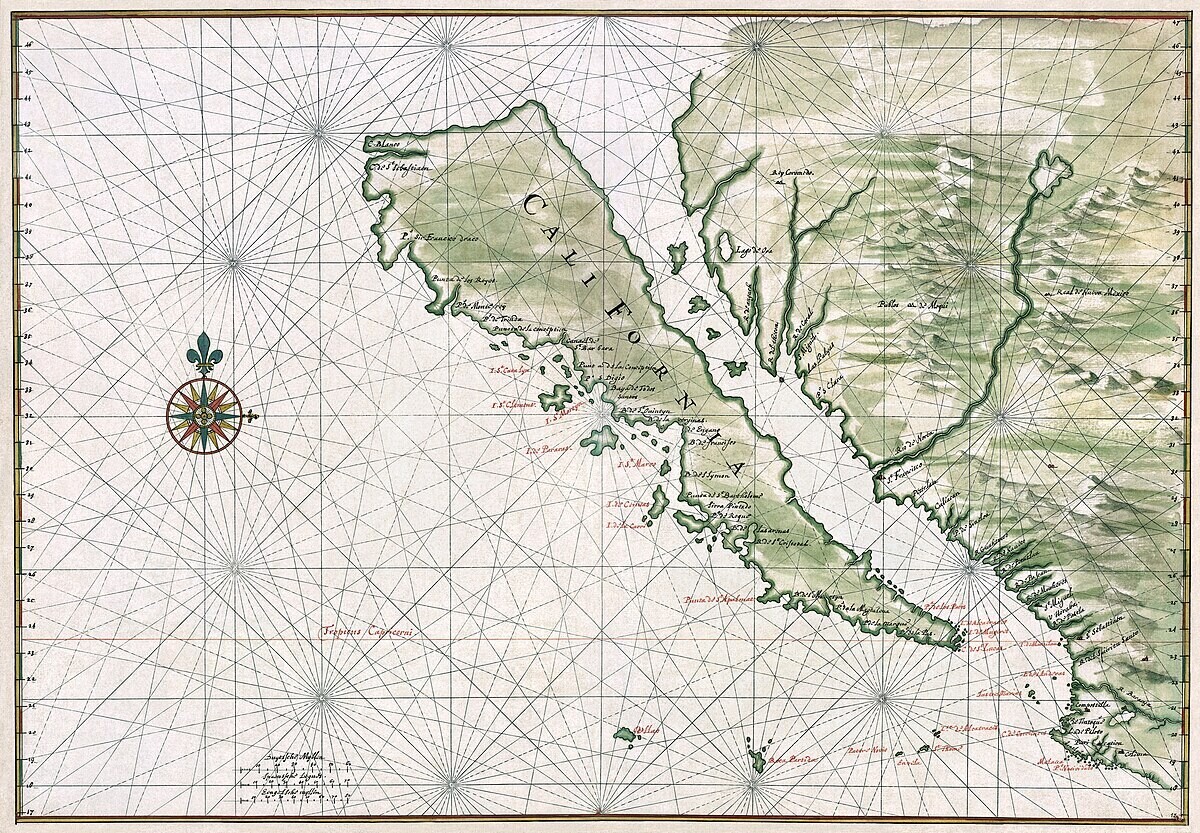
Europeans mapped California as an island based on explorers’ mistakes.
Terra Australis (Antiquity–18th c., global)
Imaginary southern continent drawn to “balance” northern lands.
Vinland (c. 1440, North Atlantic)
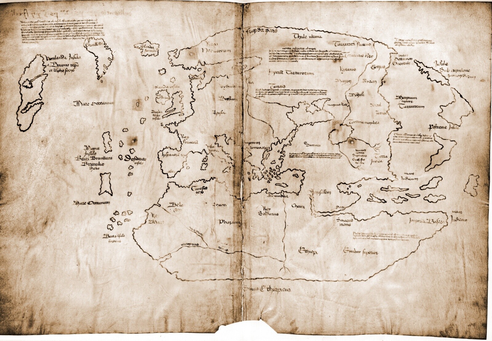
Shows supposed Viking lands in North America; may be a later fake.
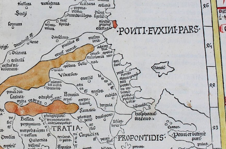
Ptolomeo (2nd c. CE, Europe)
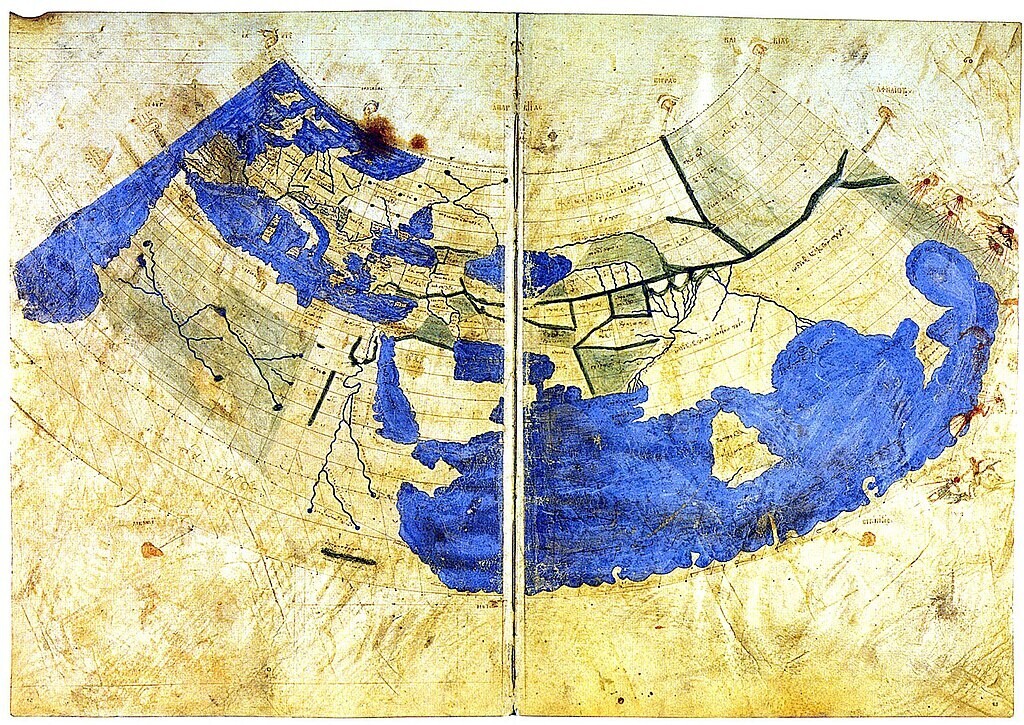
Asia too small, Indian Ocean wrongly closed off to the Mediterranean.
